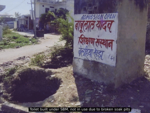
Why do we still see open garbage dumps in our neighbourhoods? Why are drains overflowing right next to newly built housing projects? Why do cities continue to struggle with managing solid, wet, grey, and black water waste, creating multiple layers of cascading problems, including environmental and health? Because cities are still being planned in silos, disconnected from the realities on the ground, it’s a deeper misalignment in how cities are conceived and built.
Planning must be systemic; it must ask how different aspects of infrastructure and services interoperate. Where are the delivery gaps? What are the risks of overlooking them? And most importantly, who is the planning being done for? The people. Beyond technical design, it’s a question of spatial equity. Who gets mapped, who gets missed, and who ultimately gets served? Urban planning must be re-imagined as a process of continuous, data-informed alignment, responsive, inclusive, and rooted in the lived experience of all city residents.
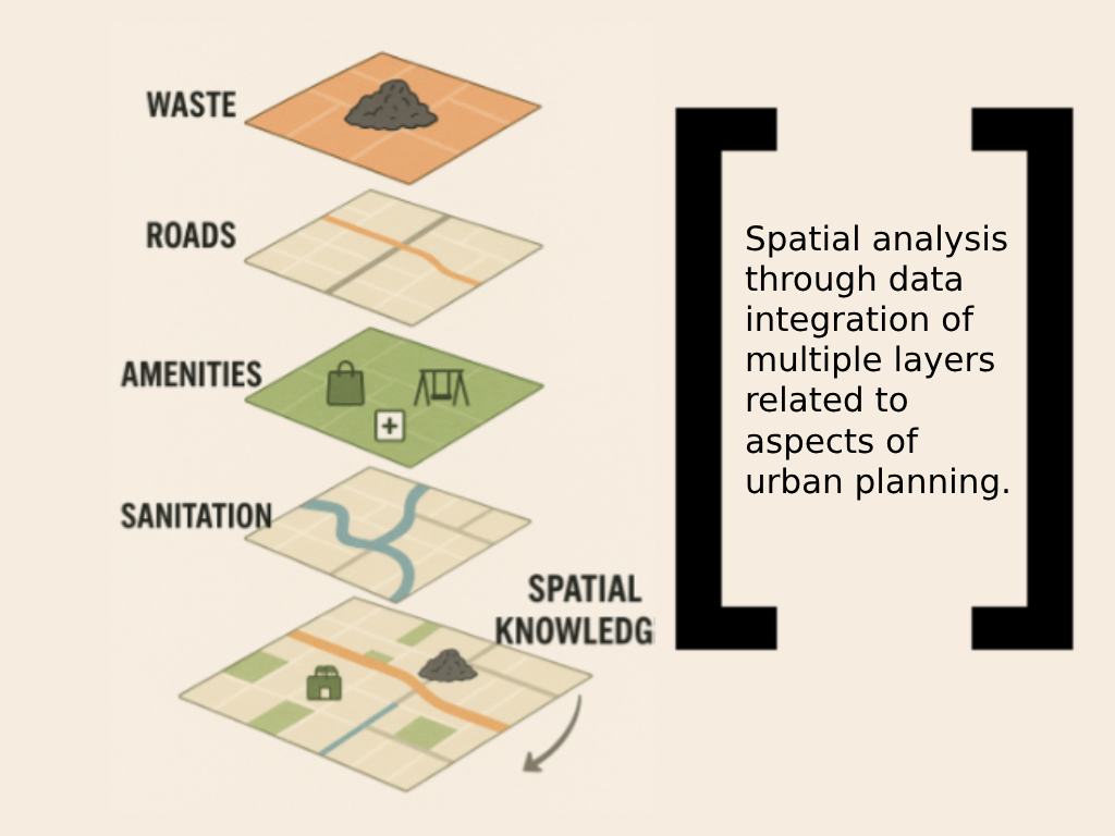
We often think of data as cold numbers, spreadsheets, and dashboards, but in urban development, data, when layered thoughtfully, tells stories. It helps planners see the city not just as a surface to be built on, but as a living, breathing space shaped by people, infrastructure, history, and aspirations. Imagine integrating datasets like land-use patterns, transportation networks, waste collection routes, sewage pipelines, and demographic data, all within a single spatial framework. Now imagine using that framework not just to see, but to plan, to anticipate where population pressures will grow, where services are lacking, and where vulnerabilities are accumulating silently. This is the promise of spatial analysis.
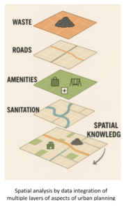
Spatial planning allows us to overlap systems that are otherwise managed in silos, storm water drainage with solid waste infrastructure, road networks with areas of resident usages, sanitation access with demographic data. With this lens, decisions aren’t made in isolation. One powerful example is the Smart Cities Mission, which has emphasised digital mapping and GIS-based planning. In India, many tier 1 cities like Pune, for instance, the municipal corporation has been working with startups and urban data experts to build a unified platform for transport, land use, drainage, and even citizen complaint sources.
But these technologies only work when they’re fed by on-ground realities and are accessible to decision-makers. This means government departments must digitise existing records, share interoperable data, and collaborate with civil society and private players. The National Urban Digital Mission (NUDM) aims to standardise such data practices across Indian cities. Yet, digitisation is not just about dashboards in municipal offices. It must also reach the ward level, to be a tool for engineers, planners, and even community leaders. Otherwise, it risks becoming yet another layer of abstraction. A truly data-informed planning model integrates, not isolates.
Here is where the lens of urban planning must evolve, from reactive service delivery to predictive, inclusive spatial strategy. The fragmented infrastructure we see today, broken toilets, overflowing bins, stagnant water, is not simply a failure of maintenance. It’s a failure of integration. When spatial tools are combined with community voices, we begin to design cities with people, not just for them.
In a tier-2 city where I have the opportunity to work with a CSO, there’s a window of possibility. These cities are still in flux, and by embedding data-informed planning practices now, they have the unique chance to leapfrog past legacy mistakes and outdated models. The opportunity isn’t just to fix what’s broken or build over, but to design urban spaces that anticipate change, adapt with resilience, and are inclusive from the start.