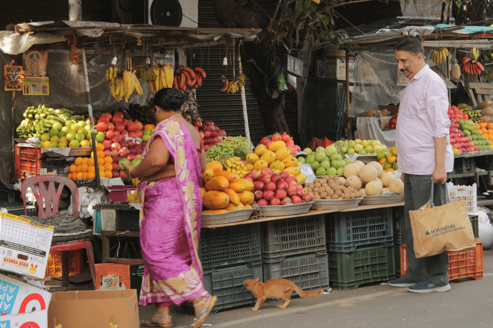
Mylapore is one of Chennai’s oldest and most storied neighborhoods, renowned for its rich cultural, religious, and architectural heritage. Many current and former Mylapore residents refer to Mylapore not just as a place, but as an emotion. Long before Chennai grew into a modern metropolis, Mylapore thrived as a bustling settlement along the Coromandel Coast, its history stretching back over two millennia. Today, it is a historic urban neighbourhood of a population of 1,50,000 to 3,00,000 divided into four different wards, and is best known for landmarks like the iconic Kapaleeshwarar Temple, vibrant street markets, classical music sabhas such as the Margazhi festival in December, and traditional kolam patterns adorning its thresholds. Yet Mylapore is more than its monuments — it is a living tapestry of communities, rituals, festivals, and everyday life that continues to reflect the enduring spirit of Chennai’s past and present.
Mylapore is also the neighbourhood where my grandparents and my family lived for 100 years, and where my mother grew up, on the street of “Pelathope,” which is Tamil for ” jackfruit grove” – also known today as Vedanta Desigar Swamy street. I used to play on the street outside my grandparents’ home and visit local shops and establishments – Moorthy Appalam, a famous shop still in Mylapore selling “appalams” or, in Hindi, “papad,” was a particular favourite.
In 1997, the Thirumylai MRTS station (the first light rail urban public transport network in South India and the second in India) was opened. It was built on top of the Buckingham Canal which runs north to south parallel to the coast, and which used to bring goods from the hinterland into the city of Madras. The MRTS reduced the carrying capacity of the canal, which became a sewer. It was also a turning point for thousands of families who lived along the canal in informal settlements, who were resettled far away from the city centre and with no access to their former livelihoods. Today, many of these families still commute 2-3 hours everyday to work in the city centre, often in the same homes where they worked previously.
When I was a masters student reading for an MSc in Sustainable Urban Development, I looked at Mylapore as a case study to better understand the social impact of public transport infrastructure, especially on social cohesion at the neighbourhood scale. I pored through archival sources and interviewed a wide cross-section of neighbourhood residents and daily users. Twenty years after the MRTS was inaugurated, its (often negative) social impact seemed to far outweigh the positive effects of greater mobility – ridership remained poor because of the cost and constraints in expanding the network and most people preferred to use the bus system despite it being woefully underfunded and overcrowded because of its better connectivity. I concluded that the MRTS had hastened the process of neighbourhood densification resulting in mixed results – real estate values were higher, but there was a reduced sense of belonging because of a high rate of demographic change. Local cultural and civic institutions couldn’t absorb these rapid changes in demography. Changes in consumption and recreation patterns also resulted in a natural death of open air markets and small traditional businesses resulting in a decline in local economic activity and quality of public spaces, further shrinking the economic space occupied by low-income families. I realised that the trends were pointing towards overall neighbourhood decline and reduction in the quality of life, health, and well-being for all classes of people.
In 2026, two more metro lines, this time as part of the Chennai Metro Rail network, are slated to be inaugurated, catalysing a new cycle of change and resettlement. I recently interviewed the owner of a family-run photography studio in Mylapore whose business had occupied the premises for over a hundred years. He was given 24 hours to move out, taking his precious memories and negatives capturing the life of the neighbourhood with him. He still can’t speak of it – he says “it’s too heavy to speak of” with tears in his eyes.
The urban theorist Kevin Lynch suggests that urban alienation can arise when city spaces are difficult to mentally map or comprehend. When the urban environment lacks clarity, individuals may feel disoriented, insecure, or even fearful, as they are unable to form a coherent mental image of their surroundings – this is especially so when the city’s built environment changes rapidly, with landmarks and heritage being lost in the blink of an eye.[1] My conclusions from my dissertation made me realise that I had a unique opportunity attempt to reverse this declining trend through small-scale but high-impact interventions, because of my embeddedness and social ties in this particular neighbourhood.
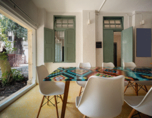
In 2023, I moved into my new office in Pelathope, Mylapore: an adaptively reused historic rowhouse from 1935. In partnership with PLUS I kicked off the first Pelathope urban design internship in the summer of 2024 as a proof of concept, with the intention of eventually creating a fellowship programme with a focus on community design and neighbourhood planning. Through a process of discourse, site observation, and neighbourhood walks, we realised Mylapore had to be conceptualised as a cultural neighbourhood, because of its rich cultural heritage. We asked ourselves the question – what would a 15 minute cultural neighbourhood look like? And we started mapping the neighbourhood creating our own categories that best encapsulated the unique cultural life of the neighbourhood – for example – speciality stores like Dabba Chetty’s ayurvedic medicine shop, or Taj Pens, a pen shop that could repair any kind of fountain nib and received visitors from all over the city for their specialised knowledge and services, was one type of cultural capital and asset that we documented. Another was the music sabhas and cultural event venues scattered across the urban fabric of Mylapore, for which it is so famous and yet for which no map exists.
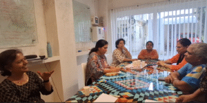
We also engaged with key stakeholders who have been involved in telling the story of Mylapore and involved in its evolution – with urban designers, historians, residents’ welfare associations, maintenance workers, street vendors, shop owners, as well as former residents who still maintain an emotional connection with the neighbourhood. And slowly, an idea began to take shape: what if I focused on creating a locally embedded neighbourhood institution whose purpose would be to act as a community anchor that could catalyse positive change through experimentation? What would that look like and what would we do?
And so I started creating a mind map of the different kinds of activities we could undertake and our basic theory of change and approach – in the past year, we have started creating a cultural map and calendar of the neighbourhood; we are building a community archive comprising oral histories, objects, photographs, maps, letters, and documents from current and former residents of Mylapore; we are engaging with volunteers and stakeholders to create a street vision for Pelathope and the larger neighbourhood of Mylapore, and conceptualising an immersive homestay and community centre in a heritage home that could be a blueprint for sustainable tourism and economic development in the neighbourhood. These and many more projects are part of a 20 year vision.
And thus, the Pelathope urban living lab (PULL) was born. In 2024, PULL also became a part of the U-CAN network as I became a U-CAN social entrepreneurship fellow.
[1] Kevin Lynch, The Image of the City (Cambridge, MA: MIT Press, 1960), 4–5.